 vesseltracker.com
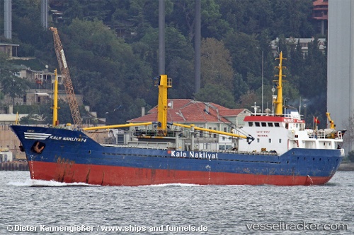
Kale Nakliyat 4
Current StatusWhere is the vessel?
Kale Nakliyat 4 is currently in Near Marmara Adasi, based on AIS data received about 4h ago.
Latest AIS update:
Current position: 40.64679° N, 27.56516° E (Near Marmara Adasi)
Average speed (last 7 days): Loading…
Average speed (last 30 days): Loading…
Vessel profile: Kale Nakliyat 4 is a General Cargo Ship with dimensions 11m x 70m.
This page combines live AIS, route history, probable destination signals, nearby traffic, and port activity for practical vessel monitoring.
The current position of vessel Kale Nakliyat 4 is 40.64679 lat / 27.56516 lng. Updated: 2026-04-09 06:42:04 UTCNearest reference points:
- Near Saraylar
- Near Marmara Adasi
- Near Erdek
Details:
Live Vessel Kale Nakliyat 4 Analytics (details, animations, etc.)
Recent AIS points (UTC):
2026-04-08 19:09:02 UTC · 40.42228, 29.00464 · SOG 8.7 kn · COG -1°2026-04-08 19:09:02 UTC · 40.42228, 29.00464 · SOG 8.7 kn · COG -1°
2026-04-09 06:42:04 UTC · 40.64679, 27.56516 · SOG 0.1 kn · COG -1°
2026-04-09 06:42:04 UTC · 40.64679, 27.56516 · SOG 0.1 kn · COG -1°