 vesseltracker.com
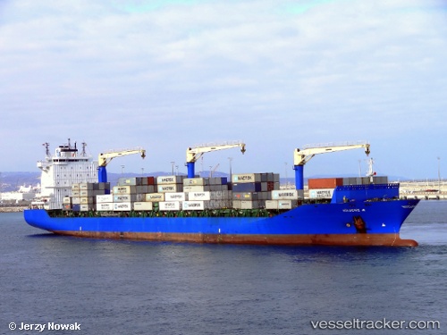
Vessel Gulbeniz A IMO: 9491850, MMSI: 271042493 Container Ship
UTC, 31.22071, 29.74906, course: -1, speed: 0.2
UTC, 31.22041, 29.74883, course: -1, speed: 0.1
2026-02-24 17:41:59 UTC, 31.22054, 29.74892, course: -1, speed: 0
Live AIS position:
UTC. Near EL DEKHEILA),
updated 2026-02-24 17:41:59 UTC.
Find the position of the vessel Gulbeniz A on the map. The latter are known coordinates and path.
marine traffic ship tracker show on live map
The current position of vessel Gulbeniz A is 31.22054 lat / 29.74892 lng. Updated: 2026-02-24 17:41:59 UTCCurrently sailing under the flag of Turkey
Gulbeniz A built in 2011 year
Deadweight:
34943 tDetails:
Last coordinates of the vessel:
UTC, 31.22057, 29.74886, course: -1, speed: 0.5UTC, 31.22071, 29.74906, course: -1, speed: 0.2
UTC, 31.22041, 29.74883, course: -1, speed: 0.1
2026-02-24 17:41:59 UTC, 31.22054, 29.74892, course: -1, speed: 0