 vesseltracker.com
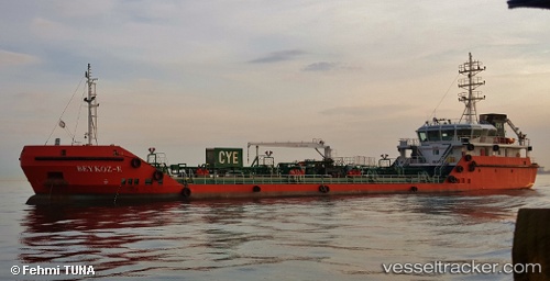
 Beykoz e
Current Status
Where is the vessel?
Beykoz e is currently in Near Davutpasa, based on AIS data received less than 1h ago.
Latest AIS update:
Current position: 40.99036° N, 28.96212° E (Near Davutpasa)
Average speed (last 7 days): Loading…
Average speed (last 30 days): Loading…
Vessel profile: Beykoz e is a Oil Products Tanker with dimensions 74m x 11m.
This page combines live AIS, route history, probable destination signals, nearby traffic, and port activity for practical vessel monitoring.
The current position of vessel Beykoz e is 40.99036 lat / 28.96212 lng. Updated: 2026-03-30 01:47:42 UTCNearest reference points:
- Near Davutpasa
- Near Mardas
- Near Hasköy
Currently sailing under the flag of Turkey ![]()
Details:
Live Vessel Beykoz e Analytics (details, animations, etc.)
Recent AIS points (UTC):
2026-03-29 19:47:42 UTC · 40.98620, 28.93335 · SOG 0.1 kn · COG -1°2026-03-29 22:23:21 UTC · 40.94275, 28.86689 · SOG 0.8 kn · COG -1°
2026-03-29 23:42:11 UTC · 40.94246, 28.86518 · SOG 0.2 kn · COG -1°
2026-03-30 01:47:42 UTC · 40.99036, 28.96212 · SOG 0.3 kn · COG -1°