 vesseltracker.com
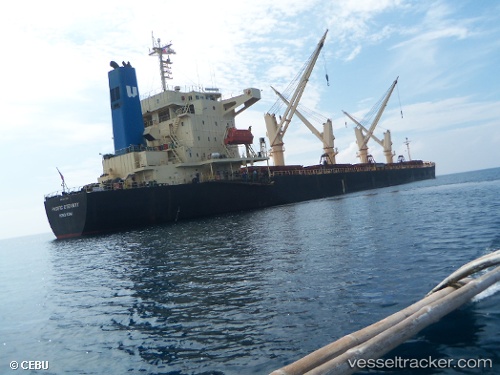
 SANITA S
Current Status
Where is the vessel?
SANITA S is currently in 38 nm W of Cap Skiring, based on AIS data received less than 1h ago.
Latest AIS update:
Current position: 12.47244° N, 17.38986° W (38 nm W of Cap Skiring)
Average speed (last 7 days): Loading…
Average speed (last 30 days): Loading…
Vessel profile: SANITA S is a Bulk Carrier with dimensions m x m.
This page combines live AIS, route history, probable destination signals, nearby traffic, and port activity for practical vessel monitoring.
The current position of vessel SANITA S is 12.47244 lat / -17.38986 lng. Updated: 2026-03-29 03:26:27 UTCNearest reference points:
- 48 nm W of Cap Skiring
- Near San Francisco Libre
- Near Banjul
Currently sailing under the flag of Turkey ![]()
SANITA S built in 2004 year
Deadweight:
46683 tDetails:
Live Vessel SANITA S Analytics (details, animations, etc.)
Recent AIS points (UTC):
2026-03-28 20:25:45 UTC · 11.29733, -17.16536 · SOG 10.3 kn · COG -1°2026-03-29 00:00:18 UTC · 12.05842, -17.31308 · SOG 10.5 kn · COG 356°
2026-03-29 01:03:10 UTC · 12.23660, -17.34667 · SOG 10.2 kn · COG 344°
2026-03-29 03:26:27 UTC · 12.47244, -17.38986 · SOG 10.4 kn · COG 349°