 vesseltracker.com
 CAN KA
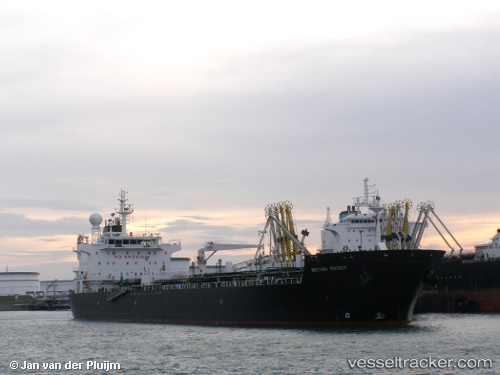
Current Status
Where is the vessel?
CAN KA is currently in Near Marmara Ereglisi, based on AIS data received about 1d ago.
Latest AIS update:
Current position: 40.96669° N, 27.98768° E (Near Marmara Ereglisi)
Average speed (last 7 days): Loading…
Average speed (last 30 days): Loading…
Vessel profile: CAN KA is a Chemical/Oil Products Tanker with dimensions 28m x 184m.
This page combines live AIS, route history, probable destination signals, nearby traffic, and port activity for practical vessel monitoring.
The current position of vessel CAN KA is 40.96669 lat / 27.98768 lng. Updated: 2026-04-10 07:43:11 UTCNearest reference points:
- Near Saraylar
- Near TEKIRDAG
- 11 nm E of Erdek
Currently sailing under the flag of Turkey ![]()
CAN KA built in 2006 year
Deadweight:
37582 tDetails:
Live Vessel CAN KA Analytics (details, animations, etc.)
Recent AIS points (UTC):
2026-04-10 02:10:55 UTC · 41.09898, 29.06292 · SOG 12.6 kn · COG 189°2026-04-10 04:04:41 UTC · 40.89424, 28.68583 · SOG 12.2 kn · COG 265°
2026-04-10 05:34:21 UTC · 40.88027, 28.28869 · SOG 12.3 kn · COG 287°
2026-04-10 07:43:11 UTC · 40.96669, 27.98768 · SOG 0.8 kn · COG 303°