 vesseltracker.com
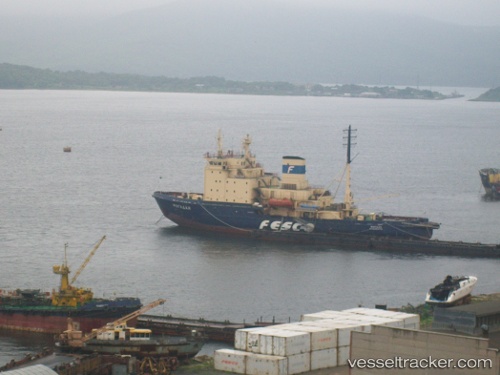
 MAGADAN
Current Status
Where is the vessel?
MAGADAN is currently in Near Vostokmorservice, based on AIS data received about 1h ago.
Latest AIS update:
Current position: 43.06565° N, 131.87531° E (Near Vostokmorservice)
Average speed (last 7 days): Loading…
Average speed (last 30 days): Loading…
Vessel profile: MAGADAN is a Icebreaker with dimensions 93m x 21m.
This page combines live AIS, route history, probable destination signals, nearby traffic, and port activity for practical vessel monitoring.
The current position of vessel MAGADAN is 43.06565 lat / 131.87531 lng. Updated: 2026-04-09 15:45:28 UTCNearest reference points:
- Near Vostokmorservice
- Near Vladivostok
- Near Dalzavod
Currently sailing under the flag of Russia ![]()
MAGADAN built in 1982 year
Deadweight:
1909 tDetails:
Live Vessel MAGADAN Analytics (details, animations, etc.)
Recent AIS points (UTC):
2026-04-09 10:19:25 UTC · 43.06570, 131.87592 · SOG 0.2 kn · COG 172°2026-04-09 11:25:51 UTC · 43.06500, 131.87500 · SOG 0 kn · COG -1°
2026-04-09 14:10:41 UTC · 43.06565, 131.87537 · SOG 0.1 kn · COG 146°
2026-04-09 15:45:28 UTC · 43.06565, 131.87531 · SOG 0.9 kn · COG 126°