 vesseltracker.com
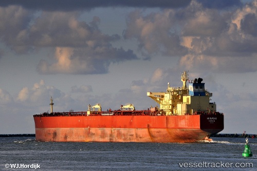
 BRATSK
Current Status
Where is the vessel?
BRATSK is currently in 28 nm SW of Al Latakia, based on AIS data received about 1h ago.
Latest AIS update:
Current position: 35.30167° N, 35.26667° E (28 nm SW of Al Latakia)
Average speed (last 7 days): Loading…
Average speed (last 30 days): Loading…
Vessel profile: BRATSK is a Crude Oil Tanker with dimensions 275m x 48m.
This page combines live AIS, route history, probable destination signals, nearby traffic, and port activity for practical vessel monitoring.
The current position of vessel BRATSK is 35.30167 lat / 35.26667 lng. Updated: 2026-04-07 01:31:21 UTCNearest reference points:
- Near Al Latakia
- Near Al Ladhiqiyah
- Near Tartous
Currently sailing under the flag of Russia ![]()
BRATSK built in 2009 year
Deadweight:
156572 tDetails:
Live Vessel BRATSK Analytics (details, animations, etc.)
Recent AIS points (UTC):
2026-04-06 20:13:18 UTC · 35.31333, 35.19500 · SOG 0 kn · COG -1°2026-04-06 21:22:19 UTC · 35.31167, 35.21333 · SOG 0 kn · COG -1°
2026-04-07 00:14:05 UTC · 35.30551, 35.24954 · SOG 0.6 kn · COG 151°
2026-04-07 01:31:21 UTC · 35.30167, 35.26667 · SOG 0 kn · COG -1°