 vesseltracker.com
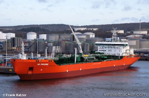
 ONEGA
ONEGA
Current Status
Where is the vessel?
ONEGA is currently in Near Gusevka, based on AIS data received about 1h ago.
Latest AIS update:
Current position: 54.90463° N, 20.02198° E (Near Gusevka)
Average speed (last 7 days): Loading…
Average speed (last 30 days): Loading…
Vessel profile: ONEGA is a Oil/Chemical Tanker with dimensions m x m.
This page combines live AIS, route history, probable destination signals, nearby traffic, and port activity for practical vessel monitoring.
The current position of vessel ONEGA is 54.90463 lat / 20.02198 lng. Updated: 2026-04-19 01:32:46 UTCNearest reference points:
- 10 nm NW of Svetlogorsk
- Near SVETLY
- Near Baltiysk
Currently sailing under the flag of Russia ![]()
Details:
Live Vessel ONEGA Analytics (details, animations, etc.)
Recent AIS points (UTC):
2026-04-18 17:33:42 UTC · 54.64342, 19.76335 · SOG 0.3 kn · COG 21°2026-04-18 19:05:41 UTC · 54.64423, 19.75962 · SOG 0.3 kn · COG -1°
2026-04-18 20:47:41 UTC · 54.64438, 19.76309 · SOG 1.2 kn · COG -1°
2026-04-19 01:32:46 UTC · 54.90463, 20.02198 · SOG 7.7 kn · COG 245°