 vesseltracker.com
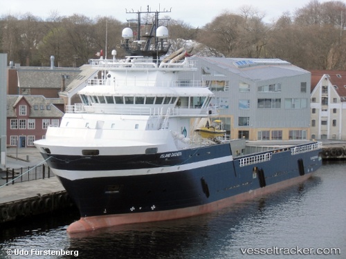
 SAYAN KNYAZ
Current Status
Where is the vessel?
SAYAN KNYAZ is currently in Near Cai Mep, based on AIS data received about 1h ago.
Latest AIS update:
Current position: 10.54808° N, 107.02541° E (Near Cai Mep)
Average speed (last 7 days): Loading…
Average speed (last 30 days): Loading…
Vessel profile: SAYAN KNYAZ is a Offshore Supply Ship with dimensions 85m x 17m.
This page combines live AIS, route history, probable destination signals, nearby traffic, and port activity for practical vessel monitoring.
The current position of vessel SAYAN KNYAZ is 10.54808 lat / 107.02541 lng. Updated: 2026-04-19 08:19:46 UTCNearest reference points:
- Near Saigon ITV/Phu My
- Near Cai Mep International Terminal
- Near Cai Mep
Currently sailing under the flag of Russia ![]()
SAYAN KNYAZ built in 2013 year
Deadweight:
3795 tDetails:
Live Vessel SAYAN KNYAZ Analytics (details, animations, etc.)
Recent AIS points (UTC):
2026-04-19 02:16:42 UTC · 10.54801, 107.02524 · SOG 0 kn · COG 316°2026-04-19 04:19:43 UTC · 10.54803, 107.02525 · SOG 0 kn · COG 316°
2026-04-19 05:44:32 UTC · 10.54667, 107.02500 · SOG 0 kn · COG -1°
2026-04-19 08:19:46 UTC · 10.54808, 107.02541 · SOG 0 kn · COG 316°