 vesseltracker.com
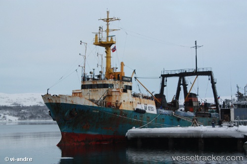
 Brest
Brest
Current Status
Where is the vessel?
Brest is currently in 99 nm NE of Polyarnyy, based on AIS data received about 15h ago.
Latest AIS update:
Current position: 69.83948° N, 37.85739° E (99 nm NE of Polyarnyy)
Average speed (last 7 days): Loading…
Average speed (last 30 days): Loading…
Vessel profile: Brest is a Fishing Vessel with dimensions 70m x 13m.
This page combines live AIS, route history, probable destination signals, nearby traffic, and port activity for practical vessel monitoring.
The current position of vessel Brest is 69.83948 lat / 37.85739 lng. Updated: 2026-04-10 07:13:56 UTCNearest reference points:
- 52 nm E of Polyarnyy
- 128 nm NE of Vardo
Currently sailing under the flag of Russia ![]()
Brest built in 1980 year
Deadweight:
901 tDetails:
Live Vessel Brest Analytics (details, animations, etc.)
Recent AIS points (UTC):
2026-04-10 02:07:53 UTC · 70.17167, 37.59333 · SOG 3 kn · COG -1°2026-04-10 04:01:51 UTC · 70.07667, 37.88833 · SOG 3 kn · COG -1°
2026-04-10 05:20:13 UTC · 69.99846, 37.96455 · SOG 3.6 kn · COG 180°
2026-04-10 07:13:56 UTC · 69.83948, 37.85739 · SOG 4 kn · COG 195°