 vesseltracker.com
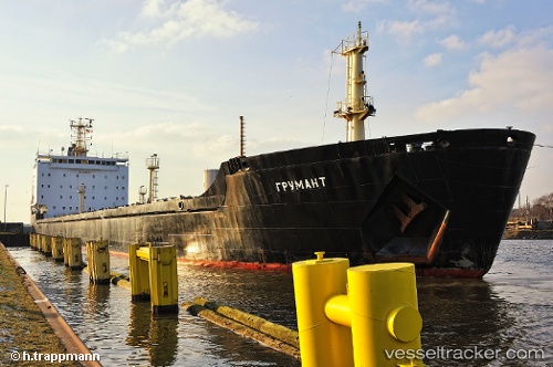
Grumant
Current StatusWhere is the vessel?
Grumant is currently in Near BENGHAZI, based on AIS data received about 1h ago.
Latest AIS update:
Current position: 32.16806° N, 19.94377° E (Near BENGHAZI)
Average speed (last 7 days): Loading…
Average speed (last 30 days): Loading…
Vessel profile: Grumant is a Bulk Carrier with dimensions 23m x 181m.
This page combines live AIS, route history, probable destination signals, nearby traffic, and port activity for practical vessel monitoring.
The current position of vessel Grumant is 32.16806 lat / 19.94377 lng. Updated: 2026-04-13 05:38:30 UTCNearest reference points:
- Near BENGHAZI
- Near Banghazi
- 61 nm N of Al Marj
Details:
Live Vessel Grumant Analytics (details, animations, etc.)
Recent AIS points (UTC):
2026-04-12 23:31:20 UTC · 32.16709, 19.94343 · SOG 0 kn · COG 109°2026-04-13 01:25:20 UTC · 32.16731, 19.94354 · SOG 0 kn · COG 117°
2026-04-13 04:05:30 UTC · 32.16791, 19.94367 · SOG 0 kn · COG 133°
2026-04-13 05:38:30 UTC · 32.16806, 19.94377 · SOG 0 kn · COG 135°