 vesseltracker.com
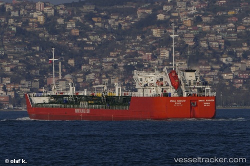
Armada Navigator
Current StatusWhere is the vessel?
Armada Navigator is currently in Near Astrakhan, based on AIS data received about 2h ago.
Latest AIS update:
Current position: 46.38867° N, 47.96240° E (Near Astrakhan)
Average speed (last 7 days): Loading…
Average speed (last 30 days): Loading…
Vessel profile: Armada Navigator is a Oil Products Tanker with dimensions 17m x 138m.
This page combines live AIS, route history, probable destination signals, nearby traffic, and port activity for practical vessel monitoring.
The current position of vessel Armada Navigator is 46.38867 lat / 47.96240 lng. Updated: 2026-04-19 05:49:06 UTCNearest reference points:
- Near Astrakhan
- Near Krasnyye Barrikady
- 20 nm N of Astrakhan
Details:
Live Vessel Armada Navigator Analytics (details, animations, etc.)
Recent AIS points (UTC):
2026-04-19 01:19:26 UTC · 46.38966, 47.96270 · SOG 8.3 kn · COG 338°2026-04-19 02:03:26 UTC · 46.36021, 48.34597 · SOG 8.4 kn · COG 321°
2026-04-19 05:49:06 UTC · 46.38867, 47.96240 · SOG 7.7 kn · COG 339°