 vesseltracker.com
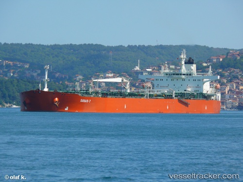
 SANAR 7
Current Status
Where is the vessel?
SANAR 7 is currently in 20 nm S of Taman', based on AIS data received about 40d ago.
Latest AIS update:
Current position: 44.88279° N, 36.77445° E (20 nm S of Taman')
Average speed (last 7 days): Loading…
Average speed (last 30 days): Loading…
Vessel profile: SANAR 7 is a Crude Oil Tanker with dimensions 249m x 44m.
This page combines live AIS, route history, probable destination signals, nearby traffic, and port activity for practical vessel monitoring.
The current position of vessel SANAR 7 is 44.88279 lat / 36.77445 lng. Updated: 2026-02-23 22:52:26 UTCNearest reference points:
- 20 nm S of Taman'
- 21 nm S of Taman'
- 17 nm S of Taman'
Currently sailing under the flag of Russia ![]()
SANAR 7 built in 2000 year
Deadweight:
113424 tDetails:
Live Vessel SANAR 7 Analytics (details, animations, etc.)
Recent AIS points (UTC):
2026-02-23 22:52:26 UTC · 44.88279, 36.77445 · SOG 0.3 kn · COG 215°