 vesseltracker.com
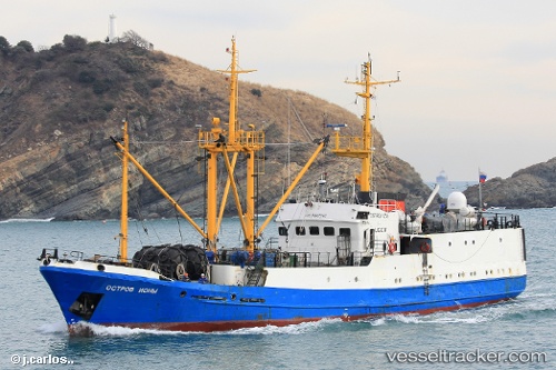
Ostrov Iony
Current StatusWhere is the vessel?
Ostrov Iony is currently in 64 nm NE of Cavle, based on AIS data received about 2h ago.
Latest AIS update:
Current position: 45.93318° N, 144.46642° E (64 nm NE of Cavle)
Average speed (last 7 days): Loading…
Average speed (last 30 days): Loading…
Vessel profile: Ostrov Iony is a Fish Carrier with dimensions 10m x 46m.
This page combines live AIS, route history, probable destination signals, nearby traffic, and port activity for practical vessel monitoring.
The current position of vessel Ostrov Iony is 45.93318 lat / 144.46642 lng. Updated: 2026-04-22 16:57:00 UTCNearest reference points:
- 45 nm SE of PRIGORODNOYE
- 40 nm N of Cavle
- 40 nm SW of Launsdorf
Details:
Live Vessel Ostrov Iony Analytics (details, animations, etc.)
Recent AIS points (UTC):
2026-04-22 11:05:25 UTC · 45.71589, 143.30701 · SOG 8.7 kn · COG 86°2026-04-22 15:18:45 UTC · 45.79793, 144.16983 · SOG 8.9 kn · COG 54°
2026-04-22 15:18:45 UTC · 45.79793, 144.16983 · SOG 8.9 kn · COG 54°
2026-04-22 16:57:00 UTC · 45.93318, 144.46642 · SOG 9.4 kn · COG 53°