 vesseltracker.com
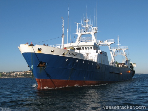
Madrus
Current StatusWhere is the vessel?
Madrus is currently in 237 nm SE of Rawson, based on AIS data received less than 1h ago.
Latest AIS update:
Current position: 44.97258° S, 60.11607° W (237 nm SE of Rawson)
Average speed (last 7 days): Loading…
Average speed (last 30 days): Loading…
Vessel profile: Madrus is a Fishing Vessel with dimensions 12m x 74m.
This page combines live AIS, route history, probable destination signals, nearby traffic, and port activity for practical vessel monitoring.
The current position of vessel Madrus is -44.97258 lat / -60.11607 lng. Updated: 2026-03-31 15:49:58 UTCDetails:
Live Vessel Madrus Analytics (details, animations, etc.)
Recent AIS points (UTC):
2026-03-31 09:30:32 UTC · -45.28497, -60.34561 · SOG 4.2 kn · COG 15°2026-03-31 11:34:49 UTC · -45.16077, -60.22792 · SOG 4.5 kn · COG 33°
2026-03-31 14:17:59 UTC · -44.97021, -60.12045 · SOG 4.7 kn · COG 23°
2026-03-31 15:49:58 UTC · -44.97258, -60.11607 · SOG 4 kn · COG 230°