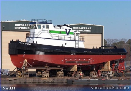
 Fells Point
Current Status
Where is the vessel?
Fells Point is currently in Near Newark, based on AIS data received about 14h ago.
Latest AIS update:
Current position: 40.68541° N, 74.15733° W (Near Newark)
Average speed (last 7 days): Loading…
Average speed (last 30 days): Loading…
Vessel profile: Fells Point is a Pusher Tug with dimensions 33m x 13m.
This page combines live AIS, route history, probable destination signals, nearby traffic, and port activity for practical vessel monitoring.
The current position of vessel Fells Point is 40.68541 lat / -74.15733 lng. Updated: 2026-05-23 11:06:35 UTCNearest reference points:
- Near Port Ivory/Staten Isl/New York
- Near Elizabethport
- Near Maher Terminal
Currently sailing under the flag of USA ![]()
Details:
Live Vessel Fells Point Analytics (details, animations, etc.)
Recent AIS points (UTC):
2026-05-23 07:47:07 UTC · 40.68092, -74.14715 · SOG 1 kn · COG 21°2026-05-23 08:06:05 UTC · 40.68848, -74.15808 · SOG 0 kn · COG 319°
2026-05-23 10:03:36 UTC · 40.68541, -74.15734 · SOG 0 kn · COG 164°
2026-05-23 11:06:35 UTC · 40.68541, -74.15733 · SOG 0 kn · COG 165°