 vesseltracker.com
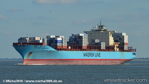
Maersk Kensington
Current StatusWhere is the vessel?
Maersk Kensington is currently in Near Norfolk, based on AIS data received about 1h ago.
Latest AIS update:
Current position: 36.87145° N, 76.34833° W (Near Norfolk)
Average speed (last 7 days): Loading…
Average speed (last 30 days): Loading…
Vessel profile: Maersk Kensington is a Container Ship with dimensions 40m x 299m.
This page combines live AIS, route history, probable destination signals, nearby traffic, and port activity for practical vessel monitoring.
The current position of vessel Maersk Kensington is 36.87145 lat / -76.34833 lng. Updated: 2026-04-01 16:05:30 UTCNearest reference points:
- Near Norfolk
- Near Sewell's Point
- Near Newport News
Details:
Live Vessel Maersk Kensington Analytics (details, animations, etc.)
Recent AIS points (UTC):
2026-04-01 10:03:17 UTC · 36.58500, -75.52500 · SOG 17 kn · COG -1°2026-04-01 11:27:45 UTC · 36.79765, -75.71113 · SOG 8.9 kn · COG 304°
2026-04-01 13:40:40 UTC · 36.95863, -76.04891 · SOG 15.5 kn · COG 287°
2026-04-01 16:05:30 UTC · 36.87145, -76.34833 · SOG 0 kn · COG 349°