 vesseltracker.com
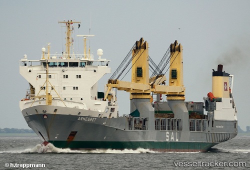
 Annegret
Current Status
Where is the vessel?
Annegret is currently in Near ZHOUSHAN, based on AIS data received less than 1h ago.
Latest AIS update:
Current position: 29.93752° N, 122.26729° E (Near ZHOUSHAN)
Average speed (last 7 days): Loading…
Average speed (last 30 days): Loading…
Vessel profile: Annegret is a Heavy Load Carrier with dimensions 152m x 21m.
This page combines live AIS, route history, probable destination signals, nearby traffic, and port activity for practical vessel monitoring.
The current position of vessel Annegret is 29.93752 lat / 122.26729 lng. Updated: 2026-04-21 07:23:23 UTCNearest reference points:
- Near ZHOUSHAN
- Near Majistan/Zhoushan
Currently sailing under the flag of Antigua Barbuda ![]()
Annegret built in 2000 year
Deadweight:
9359 tDetails:
Live Vessel Annegret Analytics (details, animations, etc.)
Recent AIS points (UTC):
2026-04-21 04:23:24 UTC · 29.93748, 122.26727 · SOG 0 kn · COG 103°2026-04-21 04:48:47 UTC · 29.93745, 122.26727 · SOG 0 kn · COG 100°
2026-04-21 06:20:08 UTC · 29.93667, 122.26667 · SOG 0 kn · COG -1°
2026-04-21 07:23:23 UTC · 29.93752, 122.26729 · SOG 0 kn · COG 101°