 vesseltracker.com
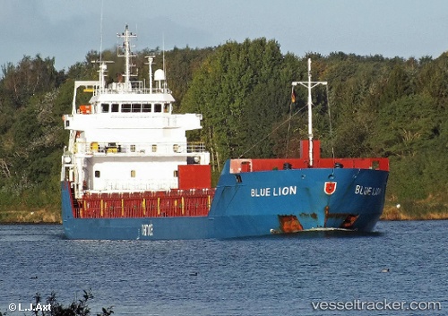
 KATJA
KATJA
Current Status
Where is the vessel?
KATJA is currently in 11 nm N of Saint-Rémy-sur-Durolle, based on AIS data received about 1h ago.
Latest AIS update:
Current position: 46.05833° N, 3.69500° W (11 nm N of Saint-Rémy-sur-Durolle)
Average speed (last 7 days): Loading…
Average speed (last 30 days): Loading…
Vessel profile: KATJA is a General Cargo with dimensions m x m.
This page combines live AIS, route history, probable destination signals, nearby traffic, and port activity for practical vessel monitoring.
The current position of vessel KATJA is 46.05833 lat / -3.69500 lng. Updated: 2026-03-31 09:41:32 UTCNearest reference points:
- Near Sennecey-le-Grand
- 17 nm S of L'Île-d'Yeu
- 13 nm S of Saint-Céols
Currently sailing under the flag of Antigua and Barbuda ![]()
Details:
Live Vessel KATJA Analytics (details, animations, etc.)
Recent AIS points (UTC):
2026-03-31 03:23:59 UTC · 45.17273, -2.91466 · SOG 8.2 kn · COG 332°2026-03-31 05:47:32 UTC · 45.48833, -3.19667 · SOG 9 kn · COG -1°
2026-03-31 07:29:53 UTC · 45.72556, -3.41604 · SOG 10.5 kn · COG 331°
2026-03-31 09:41:32 UTC · 46.05833, -3.69500 · SOG 10 kn · COG -1°