 vesseltracker.com
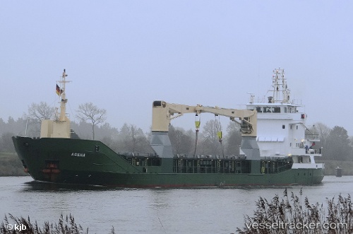
 Agena
Agena
Current Status
Where is the vessel?
Agena is currently in 173 nm E of Efpalion, based on AIS data received less than 1h ago.
Latest AIS update:
Current position: 22.44394° N, 35.57326° W (173 nm E of Efpalion)
Average speed (last 7 days): Loading…
Average speed (last 30 days): Loading…
Vessel profile: Agena is a Multi Purpose Carrier with dimensions 86m x 13m.
This page combines live AIS, route history, probable destination signals, nearby traffic, and port activity for practical vessel monitoring.
The current position of vessel Agena is 22.44394 lat / -35.57326 lng. Updated: 2026-04-20 22:05:37 UTCNearest reference points:
- 116 nm E of Efpalion
- 202 nm SE of Efpalion
Currently sailing under the flag of Antigua Barbuda ![]()
Agena built in 2001 year
Deadweight:
3414 tDetails:
Live Vessel Agena Analytics (details, animations, etc.)
Recent AIS points (UTC):
2026-04-20 17:52:42 UTC · 22.77580, -36.19649 · SOG 9.3 kn · COG 118°2026-04-20 19:52:07 UTC · 22.62309, -35.90174 · SOG 9.2 kn · COG 120°
2026-04-20 19:59:12 UTC · 22.61449, -35.88445 · SOG 9.1 kn · COG 119°
2026-04-20 22:05:37 UTC · 22.44394, -35.57326 · SOG 9.8 kn · COG 119°