 vesseltracker.com
 Marie b
Current Status
Where is the vessel?
Marie b is currently in Near Rotterdam, based on AIS data received about 1d ago.
Latest AIS update:
Current position: 51.89539° N, 4.48170° E (Near Rotterdam)
Average speed (last 7 days): Loading…
Average speed (last 30 days): Loading…
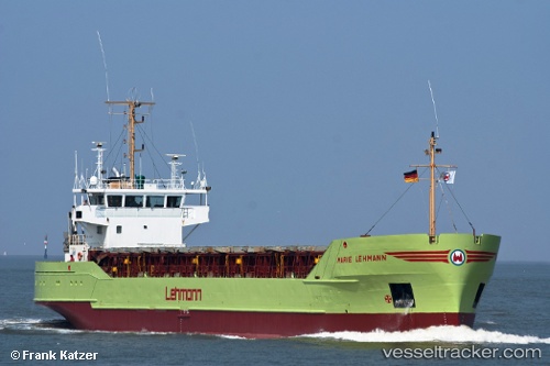
Vessel profile: Marie b is a General Cargo Ship with dimensions 80m x 13m.
This page combines live AIS, route history, probable destination signals, nearby traffic, and port activity for practical vessel monitoring.
The current position of vessel Marie b is 51.89539 lat / 4.48170 lng. Updated: 2026-04-10 07:25:05 UTCNearest reference points:
- Near Rotterdam
- Near PARKHAVEN
- Near ROTTERDAM CENTRUM
Currently sailing under the flag of Antigua Barbuda ![]()
Marie b built in 1987 year
Deadweight:
3017 tDetails:
Live Vessel Marie b Analytics (details, animations, etc.)
Recent AIS points (UTC):
2026-04-10 02:24:07 UTC · 51.90346, 4.26867 · SOG 10 kn · COG 121°2026-04-10 03:49:06 UTC · 51.89543, 4.48166 · SOG 0 kn · COG 72°
2026-04-10 05:58:06 UTC · 51.89551, 4.48159 · SOG 0 kn · COG 72°
2026-04-10 07:25:05 UTC · 51.89539, 4.48170 · SOG 0 kn · COG 72°