 vesseltracker.com
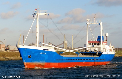
Layla
Current StatusWhere is the vessel?
Layla is currently in 27 nm NE of MARSDEN POINT, based on AIS data received about 1h ago.
Latest AIS update:
Current position: 35.50681° S, 174.87099° E (27 nm NE of MARSDEN POINT)
Average speed (last 7 days): Loading…
Average speed (last 30 days): Loading…
Vessel profile: Layla is a General Cargo Ship with dimensions 11m x 66m.
This page combines live AIS, route history, probable destination signals, nearby traffic, and port activity for practical vessel monitoring.
The current position of vessel Layla is -35.50681 lat / 174.87099 lng. Updated: 2026-03-31 11:46:55 UTCNearest reference points:
- Near MARSDEN POINT
- 10 nm NE of Russel
- Near Opua
Details:
Live Vessel Layla Analytics (details, animations, etc.)
Recent AIS points (UTC):
2026-03-31 05:30:43 UTC · -35.83441, 174.49014 · SOG 0 kn · COG 104°2026-03-31 08:11:03 UTC · -35.84833, 174.52130 · SOG 7.6 kn · COG 181°
2026-03-31 09:37:14 UTC · -35.81599, 174.68944 · SOG 10 kn · COG 30°
2026-03-31 11:46:55 UTC · -35.50681, 174.87099 · SOG 9.5 kn · COG 357°