 vesseltracker.com
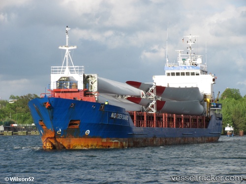
 Nordersand
Current Status
Where is the vessel?
Nordersand is currently in 25 nm W of Schoorl, based on AIS data received less than 1h ago.
Latest AIS update:
Current position: 52.82902° N, 3.95146° E (25 nm W of Schoorl)
Average speed (last 7 days): Loading…
Average speed (last 30 days): Loading…
Vessel profile: Nordersand is a General Cargo with dimensions 99m x 14m.
This page combines live AIS, route history, probable destination signals, nearby traffic, and port activity for practical vessel monitoring.
The current position of vessel Nordersand is 52.82902 lat / 3.95146 lng. Updated: 2026-04-20 17:03:12 UTCNearest reference points:
- 22 nm W of Schoorl
- 23 nm N of de Ruyter
- Near de Ruyter
Currently sailing under the flag of Antigua Barbuda ![]()
Nordersand built in 2004 year
Deadweight:
4512 tDetails:
Live Vessel Nordersand Analytics (details, animations, etc.)
Recent AIS points (UTC):
2026-04-20 13:42:11 UTC · 53.34496, 4.50805 · SOG 12.2 kn · COG -1°2026-04-20 14:28:41 UTC · 53.19705, 4.40721 · SOG 12.3 kn · COG -1°
2026-04-20 16:04:01 UTC · 52.98170, 4.03597 · SOG 10.4 kn · COG -1°
2026-04-20 17:03:12 UTC · 52.82902, 3.95146 · SOG 9.9 kn · COG 185°