 vesseltracker.com
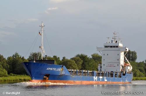
 ARIES
ARIES
Current Status
Where is the vessel?
ARIES is currently in Near BELIZE CITY, based on AIS data received less than 1h ago.
Latest AIS update:
Current position: 17.47333° N, 88.20167° W (Near BELIZE CITY)
Average speed (last 7 days): Loading…
Average speed (last 30 days): Loading…
Vessel profile: ARIES is a General Cargo with dimensions m x m.
This page combines live AIS, route history, probable destination signals, nearby traffic, and port activity for practical vessel monitoring.
The current position of vessel ARIES is 17.47333 lat / -88.20167 lng. Updated: 2026-04-12 16:22:39 UTCNearest reference points:
- 14 nm SE of Belize
- 12 nm SW of Dangriga
- 26 nm SE of Dangriga
Currently sailing under the flag of Antigua and Barbuda ![]()
Details:
Live Vessel ARIES Analytics (details, animations, etc.)
Recent AIS points (UTC):
2026-04-12 09:45:00 UTC · 17.50495, -87.92366 · SOG 9.4 kn · COG 203°2026-04-12 12:11:57 UTC · 17.36897, -88.16495 · SOG 9 kn · COG 319°
2026-04-12 13:41:50 UTC · 17.47324, -88.20115 · SOG 0.1 kn · COG 118°
2026-04-12 16:22:39 UTC · 17.47333, -88.20167 · SOG 0 kn · COG -1°