 vesseltracker.com
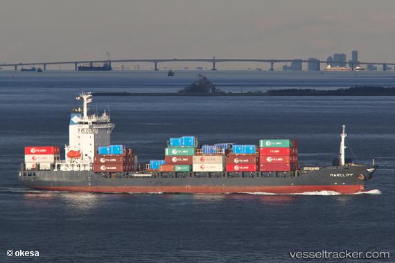
 Marcliff
Current Status
Where is the vessel?
Marcliff is currently in 15 nm SE of Fukushima, Miyazaki, based on AIS data received about 2h ago.
Latest AIS update:
Current position: 31.25634° N, 131.37320° E (15 nm SE of Fukushima, Miyazaki)
Average speed (last 7 days): Loading…
Average speed (last 30 days): Loading…
Vessel profile: Marcliff is a Container Ship with dimensions 143m x 143m.
This page combines live AIS, route history, probable destination signals, nearby traffic, and port activity for practical vessel monitoring.
The current position of vessel Marcliff is 31.25634 lat / 131.37320 lng. Updated: 2026-04-18 16:21:58 UTCNearest reference points:
- Near YAMAGAWA
- Near MIYAZAKI
- Near Kagoshima
Currently sailing under the flag of Antigua Barbuda ![]()
Marcliff built in 2007 year
Deadweight:
12779 tDetails:
Live Vessel Marcliff Analytics (details, animations, etc.)
Recent AIS points (UTC):
2026-04-18 11:26:34 UTC · 30.94910, 130.05818 · SOG 14.3 kn · COG 96°2026-04-18 13:45:28 UTC · 30.89631, 130.71950 · SOG 15.3 kn · COG 66°
2026-04-18 16:01:56 UTC · 31.20116, 131.30048 · SOG 15.3 kn · COG -1°
2026-04-18 16:21:58 UTC · 31.25634, 131.37320 · SOG 15.3 kn · COG -1°