 vesseltracker.com
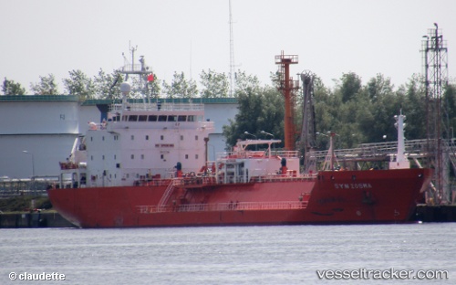
 HS ARYA
Current Status
Where is the vessel?
HS ARYA is currently in 61 nm W of Synefra-SEZ/Udupi, based on AIS data received about 18h ago.
Latest AIS update:
Current position: 13.08840° N, 73.73798° E (61 nm W of Synefra-SEZ/Udupi)
Average speed (last 7 days): Loading…
Average speed (last 30 days): Loading…
Vessel profile: HS ARYA is a Lpg Tanker with dimensions m x m.
This page combines live AIS, route history, probable destination signals, nearby traffic, and port activity for practical vessel monitoring.
The current position of vessel HS ARYA is 13.08840 lat / 73.73798 lng. Updated: 2026-04-10 06:58:10 UTCNearest reference points:
- 57 nm NW of New Mangalore
- 17 nm NW of Panamburu
- Near Mangalore
Currently sailing under the flag of Antigua and Barbuda ![]()
Details:
Live Vessel HS ARYA Analytics (details, animations, etc.)
Recent AIS points (UTC):
2026-04-10 01:54:56 UTC · 13.15779, 73.71039 · SOG 1.1 kn · COG 67°2026-04-10 03:40:16 UTC · 13.13432, 73.72167 · SOG 0.8 kn · COG 59°
2026-04-10 05:24:46 UTC · 13.11078, 73.73149 · SOG 0.7 kn · COG 62°
2026-04-10 06:58:10 UTC · 13.08840, 73.73798 · SOG 0.8 kn · COG -1°