 vesseltracker.com
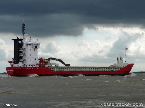
 Feed Stavanger
Current Status
Where is the vessel?
Feed Stavanger is currently in Near Seaham Harbor, based on AIS data received less than 1h ago.
Latest AIS update:
Current position: 54.85829° N, 1.29142° W (Near Seaham Harbor)
Average speed (last 7 days): Loading…
Average speed (last 30 days): Loading…
Vessel profile: Feed Stavanger is a Multi Purpose Carrier with dimensions 89m x 14m.
This page combines live AIS, route history, probable destination signals, nearby traffic, and port activity for practical vessel monitoring.
The current position of vessel Feed Stavanger is 54.85829 lat / -1.29142 lng. Updated: 2026-04-12 07:03:32 UTCNearest reference points:
- Near TYNE
- Near Blyth
- Near Hessle/Hull
Currently sailing under the flag of Antigua Barbuda ![]()
Feed Stavanger built in 1997 year
Deadweight:
4163 tDetails:
Live Vessel Feed Stavanger Analytics (details, animations, etc.)
Recent AIS points (UTC):
2026-04-10 04:20:23 UTC · 56.46431, -2.94073 · SOG 0 kn · COG 81°2026-04-10 05:20:17 UTC · 56.46431, -2.94074 · SOG 0 kn · COG 81°
2026-04-10 08:06:13 UTC · 56.46429, -2.94073 · SOG 0 kn · COG 81°
2026-04-12 07:03:32 UTC · 54.85829, -1.29142 · SOG 0.6 kn · COG 168°