 vesseltracker.com
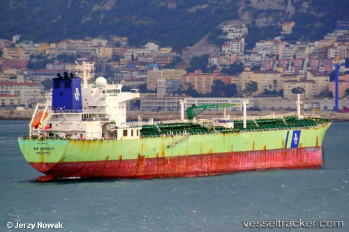
 MARALTA
Current Status
Where is the vessel?
MARALTA is currently in 12 nm NW of Okha, based on AIS data received about 1h ago.
Latest AIS update:
Current position: 22.60513° N, 68.92363° E (12 nm NW of Okha)
Average speed (last 7 days): Loading…
Average speed (last 30 days): Loading…
Vessel profile: MARALTA is a Oil Products Tanker with dimensions m x m.
This page combines live AIS, route history, probable destination signals, nearby traffic, and port activity for practical vessel monitoring.
The current position of vessel MARALTA is 22.60513 lat / 68.92363 lng. Updated: 2026-04-21 23:48:50 UTCNearest reference points:
- 13 nm W of Måndvi
- Near Khambhaliya
- Near SIKKA
Currently sailing under the flag of Antigua and Barbuda ![]()
Details:
Live Vessel MARALTA Analytics (details, animations, etc.)
Recent AIS points (UTC):
2026-04-21 19:36:40 UTC · 22.65428, 69.68497 · SOG 9 kn · COG 240°2026-04-21 21:41:29 UTC · 22.59772, 69.32607 · SOG 9.7 kn · COG 269°
2026-04-21 22:24:30 UTC · 22.63218, 69.20327 · SOG 10.6 kn · COG 295°
2026-04-21 23:48:50 UTC · 22.60513, 68.92363 · SOG 12.5 kn · COG 222°