 vesseltracker.com
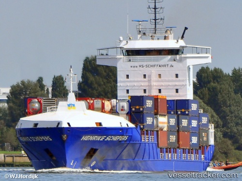
Henrike Schepers
Current StatusWhere is the vessel?
Henrike Schepers is currently in 12 nm SW of Ferrybridge, based on AIS data received less than 1h ago.
Latest AIS update:
Current position: 50.42749° N, 2.68686° W (12 nm SW of Ferrybridge)
Average speed (last 7 days): Loading…
Average speed (last 30 days): Loading…
Vessel profile: Henrike Schepers is a Container Ship with dimensions 22m x 141m.
This page combines live AIS, route history, probable destination signals, nearby traffic, and port activity for practical vessel monitoring.
The current position of vessel Henrike Schepers is 50.42749 lat / -2.68686 lng. Updated: 2026-04-17 09:52:17 UTCNearest reference points:
- Near Castletown
- Near WEYMOUTH
- 16 nm SE of Brixham
Details:
Live Vessel Henrike Schepers Analytics (details, animations, etc.)
Recent AIS points (UTC):
2026-04-17 04:10:25 UTC · 49.95919, -4.97203 · SOG 18 kn · COG 72°2026-04-17 05:45:17 UTC · 50.07970, -4.26926 · SOG 17.6 kn · COG 87°
2026-04-17 07:22:49 UTC · 50.18332, -3.54012 · SOG 18.3 kn · COG 56°
2026-04-17 09:52:17 UTC · 50.42749, -2.68686 · SOG 7.6 kn · COG 75°