 vesseltracker.com
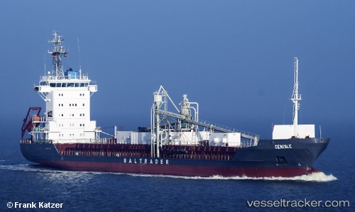
 Cemisle
Current Status
Where is the vessel?
Cemisle is currently in 14 nm SE of Craven Arms, based on AIS data received about 1h ago.
Latest AIS update:
Current position: 52.23391° N, 3.04585° E (14 nm SE of Craven Arms)
Average speed (last 7 days): Loading…
Average speed (last 30 days): Loading…
Vessel profile: Cemisle is a Cement Carrier with dimensions m x m.
This page combines live AIS, route history, probable destination signals, nearby traffic, and port activity for practical vessel monitoring.
The current position of vessel Cemisle is 52.23391 lat / 3.04585 lng. Updated: 2026-04-13 05:39:47 UTCNearest reference points:
- Near Craven Arms
- Near Hunsdon
- 21 nm S of Craven Arms
Currently sailing under the flag of Antigua Barbuda ![]()
Cemisle built in 2000 year
Deadweight:
5183 tDetails:
Live Vessel Cemisle Analytics (details, animations, etc.)
Recent AIS points (UTC):
2026-04-12 23:30:07 UTC · 53.03317, 4.10117 · SOG 9.1 kn · COG 230°2026-04-13 01:27:26 UTC · 52.82133, 3.75700 · SOG 9.3 kn · COG 215°
2026-04-13 04:05:48 UTC · 52.47028, 3.31940 · SOG 10.7 kn · COG 235°
2026-04-13 05:39:47 UTC · 52.23391, 3.04585 · SOG 11.3 kn · COG 226°