 vesseltracker.com
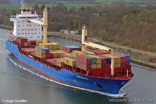
 Langeness
Current Status
Where is the vessel?
Langeness is currently in 36 nm E of ROATAN, based on AIS data received about 1h ago.
Latest AIS update:
Current position: 16.19833° N, 85.89500° W (36 nm E of ROATAN)
Average speed (last 7 days): Loading…
Average speed (last 30 days): Loading…
Vessel profile: Langeness is a Container Ship with dimensions 161m x 25m.
This page combines live AIS, route history, probable destination signals, nearby traffic, and port activity for practical vessel monitoring.
The current position of vessel Langeness is 16.19833 lat / -85.89500 lng. Updated: 2026-04-10 00:01:35 UTCNearest reference points:
- 26 nm SE of Dangriga
- 14 nm NW of Puerto Cortes
- 14 nm SE of Belize
Currently sailing under the flag of Antigua Barbuda ![]()
Langeness built in 2006 year
Deadweight:
17002 tDetails:
Live Vessel Langeness Analytics (details, animations, etc.)
Recent AIS points (UTC):
2026-04-09 18:03:37 UTC · 16.16833, -84.76500 · SOG 11 kn · COG -1°2026-04-09 19:57:57 UTC · 16.17333, -85.12333 · SOG 11 kn · COG -1°
2026-04-09 21:19:09 UTC · 16.18167, -85.37333 · SOG 11 kn · COG -1°
2026-04-10 00:01:35 UTC · 16.19833, -85.89500 · SOG 12 kn · COG -1°