 vesseltracker.com
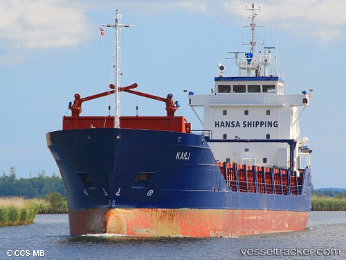
 KAILI
KAILI
Current Status
Where is the vessel?
KAILI is currently in Near HALDEN, based on AIS data received less than 1h ago.
Latest AIS update:
Current position: 59.02027° N, 11.44238° E (Near HALDEN)
Average speed (last 7 days): Loading…
Average speed (last 30 days): Loading…
Vessel profile: KAILI is a General Cargo with dimensions m x m.
This page combines live AIS, route history, probable destination signals, nearby traffic, and port activity for practical vessel monitoring.
The current position of vessel KAILI is 59.02027 lat / 11.44238 lng. Updated: 2026-04-22 12:14:00 UTCNearest reference points:
- Near STROMSTAD
- Near Utgårdskilen
- Near Brofjorden
Currently sailing under the flag of Antigua and Barbuda ![]()
Details:
Live Vessel KAILI Analytics (details, animations, etc.)
Recent AIS points (UTC):
2026-04-22 08:19:41 UTC · 59.09785, 11.27308 · SOG 9 kn · COG 76°2026-04-22 09:29:01 UTC · 59.02009, 11.44219 · SOG 0.3 kn · COG 0°
2026-04-22 10:41:52 UTC · 59.02029, 11.44226 · SOG 0 kn · COG 4°
2026-04-22 12:14:00 UTC · 59.02027, 11.44238 · SOG 0 kn · COG 355°