 vesseltracker.com
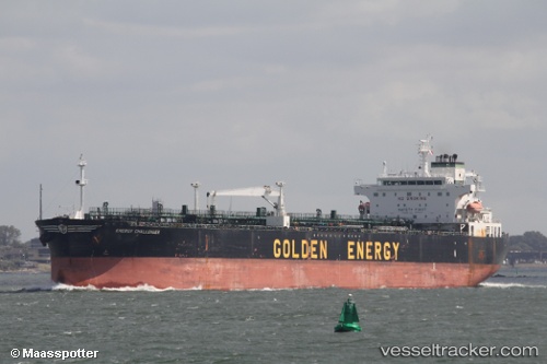
 TWENTY ONE
Current Status
Where is the vessel?
TWENTY ONE is currently in 22 nm SE of Dalian, based on AIS data received about 1h ago.
Latest AIS update:
Current position: 38.79325° N, 122.07664° E (22 nm SE of Dalian)
Average speed (last 7 days): Loading…
Average speed (last 30 days): Loading…
Vessel profile: TWENTY ONE is a Oil Products Tanker with dimensions m x m.
This page combines live AIS, route history, probable destination signals, nearby traffic, and port activity for practical vessel monitoring.
The current position of vessel TWENTY ONE is 38.79325 lat / 122.07664 lng. Updated: 2026-04-14 13:42:37 UTCNearest reference points:
- 22 nm SE of Dalian
- 20 nm E of Dalian
- 15 nm SE of Dalian
Currently sailing under the flag of Curacao ![]()
Details:
Live Vessel TWENTY ONE Analytics (details, animations, etc.)
Recent AIS points (UTC):
2026-04-14 08:13:12 UTC · 38.79550, 122.08019 · SOG 0.1 kn · COG 245°2026-04-14 10:01:09 UTC · 38.79598, 122.07984 · SOG 0.1 kn · COG 231°
2026-04-14 11:28:08 UTC · 38.79368, 122.07622 · SOG 0.3 kn · COG 27°
2026-04-14 13:42:37 UTC · 38.79325, 122.07664 · SOG 0 kn · COG 18°