 vesseltracker.com
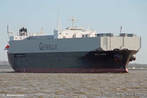
 Grouse Arrow
Current Status
Where is the vessel?
Grouse Arrow is currently in Near Nanaimo, based on AIS data received less than 1h ago.
Latest AIS update:
Current position: 49.18327° N, 123.90198° W (Near Nanaimo)
Average speed (last 7 days): Loading…
Average speed (last 30 days): Loading…
Vessel profile: Grouse Arrow is a Multi Purpose Carrier with dimensions 185m x 30m.
This page combines live AIS, route history, probable destination signals, nearby traffic, and port activity for practical vessel monitoring.
The current position of vessel Grouse Arrow is 49.18327 lat / -123.90198 lng. Updated: 2026-04-03 15:36:02 UTCNearest reference points:
- Near Nanaimo
- Near Harmac
- Near Cassidy
Currently sailing under the flag of Bahamas ![]()
Grouse Arrow built in 1991 year
Deadweight:
42276 tDetails:
Live Vessel Grouse Arrow Analytics (details, animations, etc.)
Recent AIS points (UTC):
2026-04-03 09:57:02 UTC · 49.18253, -123.89923 · SOG 0 kn · COG 285°2026-04-03 12:18:01 UTC · 49.18330, -123.90103 · SOG 0 kn · COG 119°
2026-04-03 13:24:03 UTC · 49.18348, -123.90067 · SOG 0 kn · COG 140°
2026-04-03 15:36:02 UTC · 49.18327, -123.90198 · SOG 0 kn · COG 147°