 vesseltracker.com
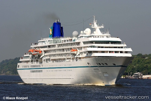
 Amadea
Current Status
Where is the vessel?
Amadea is currently in Near Pulau Tikus, based on AIS data received about 3h ago.
Latest AIS update:
Current position: 5.51764° N, 100.31249° E (Near Pulau Tikus)
Average speed (last 7 days): Loading…
Average speed (last 30 days): Loading…
Vessel profile: Amadea is a Cruise Ship with dimensions 192m x 28m.
This page combines live AIS, route history, probable destination signals, nearby traffic, and port activity for practical vessel monitoring.
The current position of vessel Amadea is 5.51764 lat / 100.31249 lng. Updated: 2026-04-12 15:44:27 UTCNearest reference points:
- Near Pulau Tikus
- Near Mak Mandin
- 10 nm NW of Air Itam/Penang
Currently sailing under the flag of Bahamas ![]()
Amadea built in 1991 year
Deadweight:
3938 tDetails:
Live Vessel Amadea Analytics (details, animations, etc.)
Recent AIS points (UTC):
2026-04-12 10:02:13 UTC · 5.42064, 100.34649 · SOG 0 kn · COG 354°2026-04-12 12:17:15 UTC · 5.42066, 100.34647 · SOG 0 kn · COG 355°
2026-04-12 13:47:12 UTC · 5.42066, 100.34649 · SOG 0 kn · COG 355°
2026-04-12 15:44:27 UTC · 5.51764, 100.31249 · SOG 11 kn · COG 307°