 vesseltracker.com
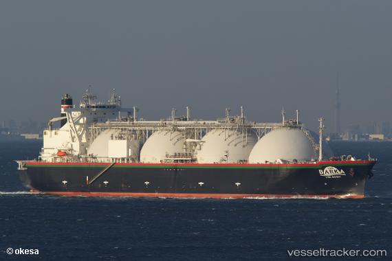
 Lng Barka
Current Status
Where is the vessel?
Lng Barka is currently in 243 nm S of Minamidaito, based on AIS data received less than 1h ago.
Latest AIS update:
Current position: 21.97833° N, 132.56332° E (243 nm S of Minamidaito)
Average speed (last 7 days): Loading…
Average speed (last 30 days): Loading…
Vessel profile: Lng Barka is a Lng Tanker with dimensions 289m x 49m.
This page combines live AIS, route history, probable destination signals, nearby traffic, and port activity for practical vessel monitoring.
The current position of vessel Lng Barka is 21.97833 lat / 132.56332 lng. Updated: 2026-03-31 21:43:16 UTCNearest reference points:
- Open sea, approx. 400 nm off the nearest listed port
- Open sea, approx. 407 nm off the nearest listed port
- Open sea, approx. 408 nm off the nearest listed port
Currently sailing under the flag of Bahamas ![]()
Lng Barka built in 2008 year
Deadweight:
82308 tDetails:
Live Vessel Lng Barka Analytics (details, animations, etc.)
Recent AIS points (UTC):
2026-03-31 15:55:16 UTC · 23.12667, 132.86333 · SOG 12 kn · COG -1°2026-03-31 18:01:17 UTC · 22.71333, 132.75667 · SOG 12 kn · COG -1°
2026-03-31 19:55:16 UTC · 22.33333, 132.65500 · SOG 12 kn · COG -1°
2026-03-31 21:43:16 UTC · 21.97833, 132.56332 · SOG 11 kn · COG -1°