 vesseltracker.com
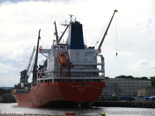
Duncan Island
Current StatusWhere is the vessel?
Duncan Island is currently in Near Puerto Bolívar, based on AIS data received about 1d ago.
Latest AIS update:
Current position: 3.23381° S, 80.00875° W (Near Puerto Bolívar)
Average speed (last 7 days): Loading…
Average speed (last 30 days): Loading…
Vessel profile: Duncan Island is a Refrigerated Cargo Ship with dimensions 25m x 180m.
This page combines live AIS, route history, probable destination signals, nearby traffic, and port activity for practical vessel monitoring.
The current position of vessel Duncan Island is -3.23381 lat / -80.00875 lng. Updated: 2026-04-10 07:16:21 UTCNearest reference points:
- Near Guayaquil
- Near Samborondon
- Near La Libertad
Details:
Live Vessel Duncan Island Analytics (details, animations, etc.)
Recent AIS points (UTC):
2026-04-10 02:14:29 UTC · -3.25473, -80.00157 · SOG 0 kn · COG -1°2026-04-10 04:15:43 UTC · -3.25475, -80.00157 · SOG 0 kn · COG 2°
2026-04-10 06:09:36 UTC · -3.25472, -80.00157 · SOG 0 kn · COG 2°
2026-04-10 07:16:21 UTC · -3.23381, -80.00875 · SOG 10.6 kn · COG 349°