 vesseltracker.com
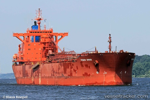
 Yeoman Bridge
Current Status
Where is the vessel?
Yeoman Bridge is currently in Near Catterline, based on AIS data received less than 1h ago.
Latest AIS update:
Current position: 56.96500° N, 1.01833° W (Near Catterline)
Average speed (last 7 days): Loading…
Average speed (last 30 days): Loading…
Vessel profile: Yeoman Bridge is a Self Discharging Bulk Carrier with dimensions 250m x 249m.
This page combines live AIS, route history, probable destination signals, nearby traffic, and port activity for practical vessel monitoring.
The current position of vessel Yeoman Bridge is 56.96500 lat / -1.01833 lng. Updated: 2026-04-19 06:20:41 UTCNearest reference points:
- Near Peterhead
- Near PETERHEAD
- Near Aberdeen
Currently sailing under the flag of Bahamas ![]()
Yeoman Bridge built in 1991 year
Deadweight:
96772 tDetails:
Live Vessel Yeoman Bridge Analytics (details, animations, etc.)
Recent AIS points (UTC):
2026-04-19 00:08:42 UTC · 55.79500, -0.05833 · SOG 12 kn · COG -1°2026-04-19 01:53:40 UTC · 56.12167, -0.33167 · SOG 12 kn · COG -1°
2026-04-19 03:14:42 UTC · 56.36833, -0.52667 · SOG 11 kn · COG -1°
2026-04-19 06:20:41 UTC · 56.96500, -1.01833 · SOG 13 kn · COG -1°