 vesseltracker.com
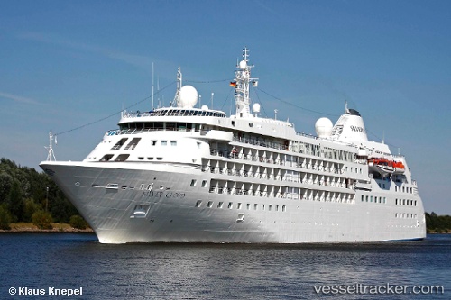
 Silver Cloud
Current Status
Where is the vessel?
Silver Cloud is currently in Near Port Shepstone, based on AIS data received less than 1h ago.
Latest AIS update:
Current position: 30.81863° S, 30.45527° E (Near Port Shepstone)
Average speed (last 7 days): Loading…
Average speed (last 30 days): Loading…
Vessel profile: Silver Cloud is a Cruise Ship with dimensions 156m x 26m.
This page combines live AIS, route history, probable destination signals, nearby traffic, and port activity for practical vessel monitoring.
The current position of vessel Silver Cloud is -30.81863 lat / 30.45527 lng. Updated: 2026-03-30 15:43:58 UTCNearest reference points:
- 23 nm E of Port Saint John's
- Near Island View
- Near Durban
Currently sailing under the flag of Bahamas ![]()
Silver Cloud built in 1994 year
Deadweight:
1564 tDetails:
Live Vessel Silver Cloud Analytics (details, animations, etc.)
Recent AIS points (UTC):
2026-03-30 09:22:36 UTC · -31.88833, 29.32167 · SOG 16 kn · COG -1°2026-03-30 12:02:01 UTC · -31.42667, 29.89833 · SOG 15 kn · COG -1°
2026-03-30 14:00:38 UTC · -31.12333, 30.22005 · SOG 13.1 kn · COG 40°
2026-03-30 15:43:58 UTC · -30.81863, 30.45527 · SOG 11.7 kn · COG 31°