 vesseltracker.com
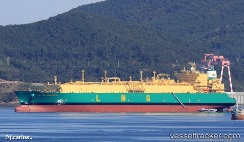
 Lng Port harcourt Ii
Current Status
Where is the vessel?
Lng Port harcourt Ii is currently in 366 nm W of Cocos Islands, based on AIS data received about 1h ago.
Latest AIS update:
Current position: 12.22797° S, 90.59765° E (366 nm W of Cocos Islands)
Average speed (last 7 days): Loading…
Average speed (last 30 days): Loading…
Vessel profile: Lng Port harcourt Ii is a Lng Tanker with dimensions 292m x 292m.
This page combines live AIS, route history, probable destination signals, nearby traffic, and port activity for practical vessel monitoring.
The current position of vessel Lng Port harcourt Ii is -12.22797 lat / 90.59765 lng. Updated: 2026-03-29 03:17:57 UTCNearest reference points:
- Open sea (no nearby ports in database)
- Open sea, approx. 417 nm off the nearest listed port
- Open sea, approx. 402 nm off the nearest listed port
Currently sailing under the flag of Bermuda ![]()
Details:
Live Vessel Lng Port harcourt Ii Analytics (details, animations, etc.)
Recent AIS points (UTC):
2026-03-28 21:48:44 UTC · -12.63387, 89.57478 · SOG 14.4 kn · COG 71°2026-03-28 23:33:54 UTC · -12.47382, 89.97226 · SOG 14.2 kn · COG 71°
2026-03-29 00:57:09 UTC · -12.35326, 90.28919 · SOG 14.7 kn · COG 72°
2026-03-29 03:17:57 UTC · -12.22797, 90.59765 · SOG 14.3 kn · COG 70°