 vesseltracker.com
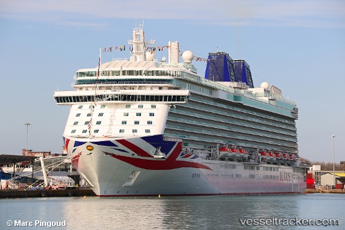
 BRITANNIA
Current Status
Where is the vessel?
BRITANNIA is currently in 41 nm N of Villanueva de Lorenzana, based on AIS data received less than 1h ago.
Latest AIS update:
Current position: 44.13169° N, 9.07651° W (41 nm N of Villanueva de Lorenzana)
Average speed (last 7 days): Loading…
Average speed (last 30 days): Loading…
Vessel profile: BRITANNIA is a Passenger with dimensions m x m.
This page combines live AIS, route history, probable destination signals, nearby traffic, and port activity for practical vessel monitoring.
The current position of vessel BRITANNIA is 44.13169 lat / -9.07651 lng. Updated: 2026-04-21 23:53:38 UTCNearest reference points:
- 30 nm NW of Meiras-Valdoviño
- 13 nm NE of Villanueva de Lorenzana
- 15 nm NW of CEDEIRA
Currently sailing under the flag of Bermuda ![]()
Details:
Live Vessel BRITANNIA Analytics (details, animations, etc.)
Recent AIS points (UTC):
2026-04-21 19:21:07 UTC · 42.96533, -9.78714 · SOG 17.5 kn · COG 358°2026-04-21 21:30:03 UTC · 43.53235, -9.51750 · SOG 17.1 kn · COG 34°
2026-04-21 22:39:15 UTC · 43.81288, -9.30253 · SOG 16.8 kn · COG 26°
2026-04-21 23:53:38 UTC · 44.13169, -9.07651 · SOG 17.2 kn · COG 28°