 vesseltracker.com
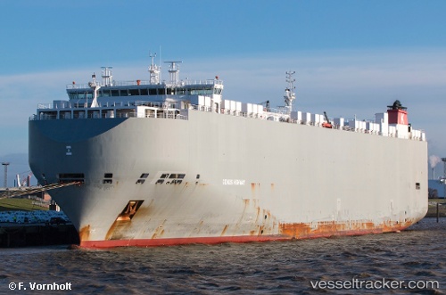
 Genius Highway
Current Status
Where is the vessel?
Genius Highway is currently in 93 nm SE of Gonubie, based on AIS data received about 1h ago.
Latest AIS update:
Current position: 33.75114° S, 29.59532° E (93 nm SE of Gonubie)
Average speed (last 7 days): Loading…
Average speed (last 30 days): Loading…
Vessel profile: Genius Highway is a Vehicles Carrier with dimensions 200m x 32m.
This page combines live AIS, route history, probable destination signals, nearby traffic, and port activity for practical vessel monitoring.
The current position of vessel Genius Highway is -33.75114 lat / 29.59532 lng. Updated: 2026-03-31 21:30:38 UTCNearest reference points:
- 23 nm E of Port Saint John's
Currently sailing under the flag of Bahamas ![]()
Genius Highway built in 2014 year
Deadweight:
19974 tDetails:
Live Vessel Genius Highway Analytics (details, animations, etc.)
Recent AIS points (UTC):
2026-03-31 17:40:54 UTC · -33.82905, 28.52244 · SOG 12.8 kn · COG 81°2026-03-31 19:25:45 UTC · -33.79500, 28.99667 · SOG 14 kn · COG -1°
2026-03-31 19:25:45 UTC · -33.79500, 28.99667 · SOG 14 kn · COG -1°
2026-03-31 21:30:38 UTC · -33.75114, 29.59532 · SOG 15 kn · COG 81°