 vesseltracker.com
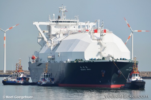
 Seishu Maru
Current Status
Where is the vessel?
Seishu Maru is currently in 243 nm SW of Omura, based on AIS data received about 1h ago.
Latest AIS update:
Current position: 23.35204° N, 140.42386° E (243 nm SW of Omura)
Average speed (last 7 days): Loading…
Average speed (last 30 days): Loading…
Vessel profile: Seishu Maru is a Lng Tanker with dimensions 288m x 49m.
This page combines live AIS, route history, probable destination signals, nearby traffic, and port activity for practical vessel monitoring.
The current position of vessel Seishu Maru is 23.35204 lat / 140.42386 lng. Updated: 2026-04-02 07:04:03 UTCNearest reference points:
- Open sea, approx. 402 nm off the nearest listed port
- Open sea, approx. 403 nm off the nearest listed port
- Open sea, approx. 401 nm off the nearest listed port
Currently sailing under the flag of Bahamas ![]()
Details:
Live Vessel Seishu Maru Analytics (details, animations, etc.)
Recent AIS points (UTC):
2026-04-02 01:47:41 UTC · 23.32915, 140.28671 · SOG 1.9 kn · COG 64°2026-04-02 03:03:29 UTC · 23.34080, 140.31223 · SOG 1.2 kn · COG 102°
2026-04-02 06:17:21 UTC · 23.33820, 140.39832 · SOG 3.1 kn · COG 109°
2026-04-02 07:04:03 UTC · 23.35204, 140.42386 · SOG 1.6 kn · COG 65°