 vesseltracker.com
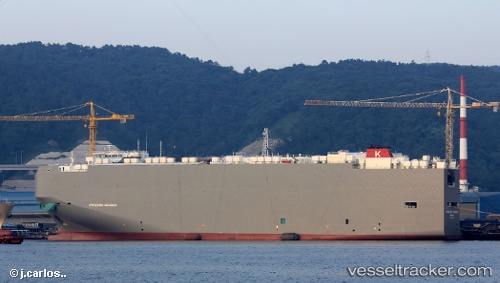
Hyperion Highway
Current StatusWhere is the vessel?
Hyperion Highway is currently in 162 nm N of Juan Fernández, based on AIS data received less than 1h ago.
Latest AIS update:
Current position: 31.09353° S, 80.72817° W (162 nm N of Juan Fernández)
Average speed (last 7 days): Loading…
Average speed (last 30 days): Loading…
Vessel profile: Hyperion Highway is a Vehicles Carrier with dimensions 36m x 200m.
This page combines live AIS, route history, probable destination signals, nearby traffic, and port activity for practical vessel monitoring.
The current position of vessel Hyperion Highway is -31.09353 lat / -80.72817 lng. Updated: 2026-04-14 03:46:09 UTCDetails:
Live Vessel Hyperion Highway Analytics (details, animations, etc.)
Recent AIS points (UTC):
2026-04-13 22:22:09 UTC · -31.64500, -78.90333 · SOG 18 kn · COG -1°2026-04-14 00:22:08 UTC · -31.45500, -79.58500 · SOG 18 kn · COG -1°
2026-04-14 02:06:09 UTC · -31.28042, -80.17002 · SOG 18.2 kn · COG 291°
2026-04-14 03:46:09 UTC · -31.09353, -80.72817 · SOG 18.5 kn · COG 290°