 vesseltracker.com
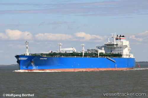
Concorde
Current StatusWhere is the vessel?
Concorde is currently in 139 nm SW of Morro Redondo, based on AIS data received about 1h ago.
Latest AIS update:
Current position: 26.02333° N, 116.43333° W (139 nm SW of Morro Redondo)
Average speed (last 7 days): Loading…
Average speed (last 30 days): Loading…
Vessel profile: Concorde is a Lpg Tanker with dimensions 36m x 225m.
This page combines live AIS, route history, probable destination signals, nearby traffic, and port activity for practical vessel monitoring.
The current position of vessel Concorde is 26.02333 lat / -116.43333 lng. Updated: 2026-04-19 16:35:48 UTCDetails:
Live Vessel Concorde Analytics (details, animations, etc.)
Recent AIS points (UTC):
2026-04-19 13:26:54 UTC · 26.56755, -117.07538 · SOG 15.5 kn · COG 133°2026-04-19 13:26:54 UTC · 26.56755, -117.07538 · SOG 15.5 kn · COG 133°
2026-04-19 15:52:05 UTC · 26.14742, -116.58068 · SOG 14.8 kn · COG 134°
2026-04-19 16:35:48 UTC · 26.02333, -116.43333 · SOG 14 kn · COG -1°