 vesseltracker.com
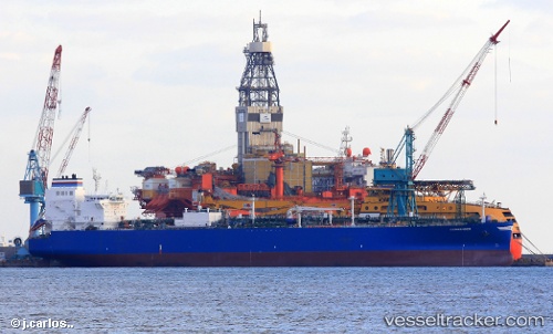
 Commander
Current Status
Where is the vessel?
Commander is currently in 79 nm S of Puerto Ángel, based on AIS data received about 1d ago.
Latest AIS update:
Current position: 14.36118° N, 96.59955° W (79 nm S of Puerto Ángel)
Average speed (last 7 days): Loading…
Average speed (last 30 days): Loading…
Vessel profile: Commander is a Lpg Tanker with dimensions 225m x 36m.
This page combines live AIS, route history, probable destination signals, nearby traffic, and port activity for practical vessel monitoring.
The current position of vessel Commander is 14.36118 lat / -96.59955 lng. Updated: 2026-04-10 07:46:53 UTCCurrently sailing under the flag of Bahamas ![]()
Details:
Live Vessel Commander Analytics (details, animations, etc.)
Recent AIS points (UTC):
2026-04-10 02:41:22 UTC · 14.94333, -97.85667 · SOG 15 kn · COG -1°2026-04-10 04:20:18 UTC · 14.75667, -97.45500 · SOG 15 kn · COG -1°
2026-04-10 05:26:50 UTC · 14.62970, -97.18346 · SOG 15.9 kn · COG 111°
2026-04-10 07:46:53 UTC · 14.36118, -96.59955 · SOG 15.8 kn · COG 113°