 vesseltracker.com
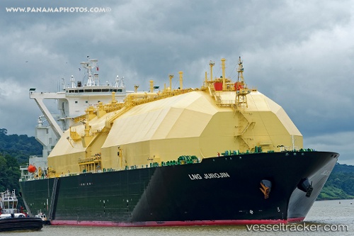
 Lng Jurojin
Current Status
Where is the vessel?
Lng Jurojin is currently in 39 nm SW of Amio, based on AIS data received about 11h ago.
Latest AIS update:
Current position: 6.71640° S, 150.49472° E (39 nm SW of Amio)
Average speed (last 7 days): Loading…
Average speed (last 30 days): Loading…
Vessel profile: Lng Jurojin is a Lng Tanker with dimensions 288m x 49m.
This page combines live AIS, route history, probable destination signals, nearby traffic, and port activity for practical vessel monitoring.
The current position of vessel Lng Jurojin is -6.71640 lat / 150.49472 lng. Updated: 2026-04-10 07:12:06 UTCNearest reference points:
- 42 nm E of Tami Island
- 15 nm SW of Lambom Island
- Near Rabaul
Currently sailing under the flag of Bahamas ![]()
Details:
Live Vessel Lng Jurojin Analytics (details, animations, etc.)
Recent AIS points (UTC):
2026-04-10 02:33:59 UTC · -6.89331, 150.56818 · SOG 2.5 kn · COG 124°2026-04-10 03:29:55 UTC · -6.85638, 150.55450 · SOG 2.5 kn · COG 121°
2026-04-10 06:01:37 UTC · -6.75954, 150.51341 · SOG 2.5 kn · COG 128°
2026-04-10 07:12:06 UTC · -6.71640, 150.49472 · SOG 2.4 kn · COG 128°