 vesseltracker.com
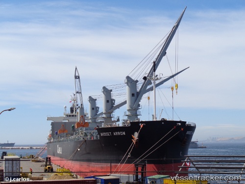
 Avocet Arrow
Current Status
Where is the vessel?
Avocet Arrow is currently in 16 nm NE of Caioba, based on AIS data received less than 1h ago.
Latest AIS update:
Current position: 25.69503° S, 48.28326° W (16 nm NE of Caioba)
Average speed (last 7 days): Loading…
Average speed (last 30 days): Loading…
Vessel profile: Avocet Arrow is a Bulk Carrier with dimensions 200m x 200m.
This page combines live AIS, route history, probable destination signals, nearby traffic, and port activity for practical vessel monitoring.
The current position of vessel Avocet Arrow is -25.69503 lat / -48.28326 lng. Updated: 2026-03-31 04:05:18 UTCNearest reference points:
- 24 nm E of Caioba
- 32 nm E of Caioba
- 10 nm NE of CAMBORIU
Currently sailing under the flag of Bahamas ![]()
Details:
Live Vessel Avocet Arrow Analytics (details, animations, etc.)
Recent AIS points (UTC):
2026-03-30 21:50:01 UTC · -25.69500, -48.28167 · SOG 0 kn · COG -1°2026-03-31 00:20:21 UTC · -25.69560, -48.28315 · SOG 0.5 kn · COG 79°
2026-03-31 01:23:16 UTC · -25.69545, -48.28323 · SOG 0.2 kn · COG 86°
2026-03-31 04:05:18 UTC · -25.69503, -48.28326 · SOG 0.2 kn · COG 95°