 vesseltracker.com
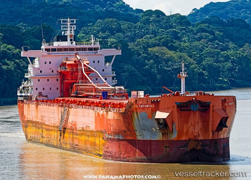
 Csl Tarantau
Current Status
Where is the vessel?
Csl Tarantau is currently in Near Port Hastings, based on AIS data received about 1h ago.
Latest AIS update:
Current position: 45.64113° N, 61.41940° W (Near Port Hastings)
Average speed (last 7 days): Loading…
Average speed (last 30 days): Loading…
Vessel profile: Csl Tarantau is a Self Discharging Bulk Carrier with dimensions 220m x 220m.
This page combines live AIS, route history, probable destination signals, nearby traffic, and port activity for practical vessel monitoring.
The current position of vessel Csl Tarantau is 45.64113 lat / -61.41940 lng. Updated: 2026-04-16 14:03:26 UTCNearest reference points:
- Near Goldboro
- 20 nm S of Head of Jeddore
- 31 nm SE of Bald Rock
Currently sailing under the flag of Bahamas ![]()
Csl Tarantau built in 2013 year
Deadweight:
71500 tDetails:
Live Vessel Csl Tarantau Analytics (details, animations, etc.)
Recent AIS points (UTC):
2026-04-16 07:09:21 UTC · 45.64120, -61.41940 · SOG 0 kn · COG 94°2026-04-16 10:18:22 UTC · 45.64119, -61.41939 · SOG 0 kn · COG 94°
2026-04-16 11:30:20 UTC · 45.64119, -61.41941 · SOG 0 kn · COG 94°
2026-04-16 14:03:26 UTC · 45.64113, -61.41940 · SOG 0 kn · COG 94°