 vesseltracker.com
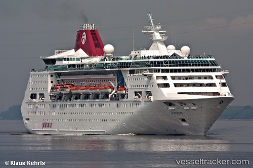
 EMPRESS OF THE SEAS
Current Status
Where is the vessel?
EMPRESS OF THE SEAS is currently in 42 nm NW of Amini Island, based on AIS data received less than 1h ago.
Latest AIS update:
Current position: 11.69333° N, 72.32167° E (42 nm NW of Amini Island)
Average speed (last 7 days): Loading…
Average speed (last 30 days): Loading…
Vessel profile: EMPRESS OF THE SEAS is a Cruise Ship with dimensions 30m x 211m.
This page combines live AIS, route history, probable destination signals, nearby traffic, and port activity for practical vessel monitoring.
The current position of vessel EMPRESS OF THE SEAS is 11.69333 lat / 72.32167 lng. Updated: 2026-04-21 22:16:32 UTCNearest reference points:
- 13 nm NW of Lakshadweep
- 57 nm NW of New Mangalore
- 130 nm W of Lakshadweep
Currently sailing under the flag of Bahamas ![]()
EMPRESS OF THE SEAS built in 1990 year
Deadweight:
4978 tDetails:
Live Vessel EMPRESS OF THE SEAS Analytics (details, animations, etc.)
Recent AIS points (UTC):
2026-04-21 19:28:05 UTC · 12.25500, 72.25833 · SOG 13 kn · COG -1°2026-04-21 19:34:05 UTC · 12.23333, 72.25833 · SOG 13 kn · COG -1°
2026-04-21 21:37:22 UTC · 11.81167, 72.31333 · SOG 11 kn · COG -1°
2026-04-21 22:16:32 UTC · 11.69333, 72.32167 · SOG 11 kn · COG -1°